
Tonga is located within the ‘Ring of Fire’ in the South Pacific and is vulnerable to natural disasters including tropical cyclones, flooding and storm surges, earthquakes, tsunami, volcanic eruptions, and a raft of emergencies resulting from global warming and climate change.
The National Emergency Management Office (NEMO) is responsible for emergency management in the Kingdom of Tonga. GRID Tonga supports NEMO’s Mission to build the capacity of the Tonga community by developing and implementing appropriate and effective disaster risk management policies, plans and programmes to address current and emerging threats from disasters.
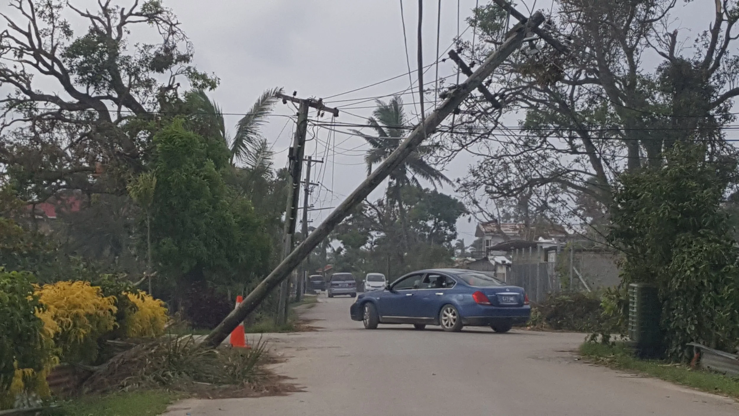
On February 12th, 2018, Tonga was hit by Cyclone Gita, a devastating Category 4-5 tropical cyclone, destroying infrastructure, agriculture, buildings, and homes, leaving Tongatapu and its neighbouring island ‘Eua without power, little water, and compromised food supplies.
On February 14th, 2018, two days after Tonga was hit by Cyclone Gita, the GRID Tonga team returned to Tonga and acquired data and imagery across all the main roads and villages of Tongatapu.
The post Cyclone Gita Street View data and imagery acquired in February 2018 also has accurate GPS location data and was provided to the Tonga National Emergency Management Office. This can be used for investigation, research, scoping, project planning, and analysis by those involved in emergency planning and management research and development, and support ministries and agencies with climate change management and disaster response and resilience. The data will also be useful for assessing the extent of damage to infrastructure (e.g. roading, power, water), buildings, and housing (e.g. pre and post cyclone), which can support the design, development, and management of recovery efforts.

Street View imagery of infrastructure damage from cyclone Gita