TE HA Moana - Pacific Languages in Google Earth Layer

Our nearly 40 Polynesian languages grew from seeds sown over 9000 years ago in the West Pacific island of Taiwan. Since then and for thousands of years, as Kaivai (literally “eaters of water” - great ocean mariners and navigators) our people, cultures, and languages have journeyed far across te moana (the ocean) traveling as far east as Tahiti, Rapa Nui - even to Peru where we brought back the delicious kumara (sweet potato). Our indomitable ancestors travelled south to Aotearoa and north to islands we call Hawai’i.

The fact that all of our Polynesian cultures and languages have strong commonalities is testament to our skill as native scientists, wayfinders, and seafarers. Star systems and diverse environmental phenomena were recorded with extensive lexicons, creative symbologies, and sophisticated technologies.

Our languages reflect who we are from birth to death. They are languages of love, laughter, and passion – they eloquently express our deepest sorrows and our sweetest joys. They are languages of action – of exciting adventures - of following the journeys of Maui and Kupe within the vast domain of Tangaroa (the guardian of the oceans).

Now millions of people can access Google Earth and this Indigenous language layer - and through this initiative we hope that people will understand how important our languages are to us all in the Pacific.

Check it out here

Celebrating Indigenous Languages

Tania also gave a speech at the United Nations HQ in New York as they celebrated the International Day of the World’s Indigenous Peoples. Here is a copy of Tania’s speech.

You can view Tania’s speech following the introduction and talk by Google Earth Senior Program Manager Raleigh Seamster at 42:14 secs of this UN TV Video: http://webtv.un.org/search/part-2-2019-international-day-of-the-worlds-indigenous-peoples-theme-indigenous-peoples%E2%80%99-languages/6070893828001/?term=indigenous%20languages&sort=date&page=7

For more information about Indigenous Languages, please see:

https://www.un.org/development/desa/indigenouspeoples/news/2019/07/international-day-of-the-worlds-indigenous-peoples-2019/

www.un.org/en/events/indigenousday

https://www.facebook.com/events/1022104261313562/

On Twitter follow #WeAreIndigenous #IndigenousPeoplesDay #IndigenousLanguage

GRID Raro Starts

LOST IN PARADISE - GOOGLE STREET VIEW HEADS TO RAROTONGA

The Cook Islands is a country, an island, in the middle of the South Pacific Ocean. One of the regions fastest growing economies, with fibre optic cable coming for greater global connectivity, it’s a citizen of the NZ realm, a developing nation. Today the Cook Islands is firmly on the radar of foreign super powers. Yet local Stan Wolfgramm still has to describe the directions to his house as, “drive past the airport, heading away from town, turn inland at super brown, head to the end of the road till you hit the back road, then turn right, take the third driveway inland, you’ll pass three coconut trees on your left and when you come to the big mango tree on your right, turn in here. I’m in the last house down the drive, the one with a green roof. Please hurry my son has had a fall … or please hurry my house is on fire…”

Is there a problem, Stan asks? “Well, I guess if you need an ambulance or your house is on fire, then yes there is. Actually, it’s more of a mindset that we’ve learnt to live with, but for how long do we continue to live with it? Is there an alternative?”

To have roads, houses, businesses, historical sites, emergency infrastructure mapped and available is today, for most countries, not just a luxury but a necessity. Providing important information for research and development to support ministries with climate change management, disaster response and resilience planning, for education, for business development, for cultural sustainability etc, etc.

In February, a collective of Pacific islanders, GRID Pacific, working to better the situation of Pacific peoples, will begin trials and, weather permitting, will map and ‘Street View’ Rarotonga's entire road infrastructure.

Director of the Global Reach Initiative Tania Wolfgramm says that “having high quality 3D imagery in Google Street View will be a positive change for the Cook Islands. Creating and publishing Street View imagery to global platforms, including Google Maps and Google Earth will open up opportunities that currently do not exist in emergency management, in tourism, business, and education and will take what currently exists to the next level”.

Tania and Wikuki Kingi work to promote platforms that allow Pacific people to express their own Pacific voice. They met with Google in San Francisco whom were happy to support the initiative but, because of the Pacific region’s isolation and small populations, saw this happening in partnership with someone who was prepared and passionate enough to manage the in-country workload and expense.        

The GRID Cook Islands team will be working in collaboration with the Director of Emergency Management, Mr Charles Carlson, the Ministry of Tourism, and local partner Mr Stan Wolfgramm of Te Ara Cook Islands Museum of Cultural Enterprise.  

Look out for our car with a special street view camera mounted to the roof, as the GRID Raro team drive through Raro villages between the 8th and 15th of February. As GRID Raro Manager and Creative Specialist Wikuki Kingi says, “This is a great time to ‘look sharp’. Prepare your village not just for friends and family abroad but to meet the world as we share wonderful imagery of Rarotonga, capturing the imagination of millions of people everywhere.”

Janni sets up street view camera, testing capture and process before it heads to Rarotonga

Janni sets up street view camera, testing capture and process before it heads to Rarotonga

GRID Tonga acquires Street View data after Cyclone Gita

Tonga is located within the ‘Ring of Fire’ in the South Pacific and is vulnerable to natural disasters including tropical cyclones, flooding and storm surges, earthquakes, tsunami, volcanic eruptions, and a raft of emergencies resulting from global warming and climate change. 

The National Emergency Management Office (NEMO) is responsible for emergency management in the Kingdom of Tonga. GRID Tonga supports NEMO’s Mission to build the capacity of the Tonga community by developing and implementing appropriate and effective disaster risk management policies, plans and programmes to address current and emerging threats from disasters. 

On February 12th, 2018, Tonga was hit by Cyclone Gita, a devastating Category 4-5 tropical cyclone, destroying infrastructure, agriculture, buildings, and homes, leaving Tongatapu and its neighbouring island ‘Eua without power, little water, and compromised food supplies.

On February 14th, 2018, two days after Tonga was hit by Cyclone Gita, the GRID Tonga team returned to Tonga and acquired data and imagery across all the main roads and villages of Tongatapu.

The post Cyclone Gita Street View data and imagery acquired in February 2018 also has accurate GPS location data and was provided to the Tonga National Emergency Management Office.  This can be used for investigation, research, scoping, project planning, and analysis by those involved in emergency planning and management research and development, and support ministries and agencies with climate change management and disaster response and resilience.  The data will also be useful for assessing the extent of damage to infrastructure (e.g. roading, power, water), buildings, and housing (e.g. pre and post cyclone), which can support the design, development, and management of recovery efforts.

Street View imagery of infrastructure damage from cyclone Gita

Street View imagery of infrastructure damage from cyclone Gita

Google Street View coming to Tonga

GRID Tonga to start Google Street View data capture in December

Starting in Tongatapu on the 6th December, the Global Reach Initiative and Development (GRID) Tonga team will be driving around Nuku’alofa and sixty-four villages across the island with special 360° cameras to add each community to Google Street View. They will record panoramic, high-resolution, three-dimensional (3D) imagery that is linked to accurate Global Positioning System (GPS) data. These images will be displayed in Google Earth and can be accessed through Google Maps as web and mobile applications.

Director of the Global Reach Initiative Tania Wolfgramm says that “having 3D imagery in Google Street View will be a game changer for Tonga. Creating and publishing Street View imagery to global platforms, including Google Maps and Google Earth will open up opportunities in education, tourism, and business.” The Street View data will also provide important information for research and development, which can support ministries with climate change management and disaster response and resilience planning.

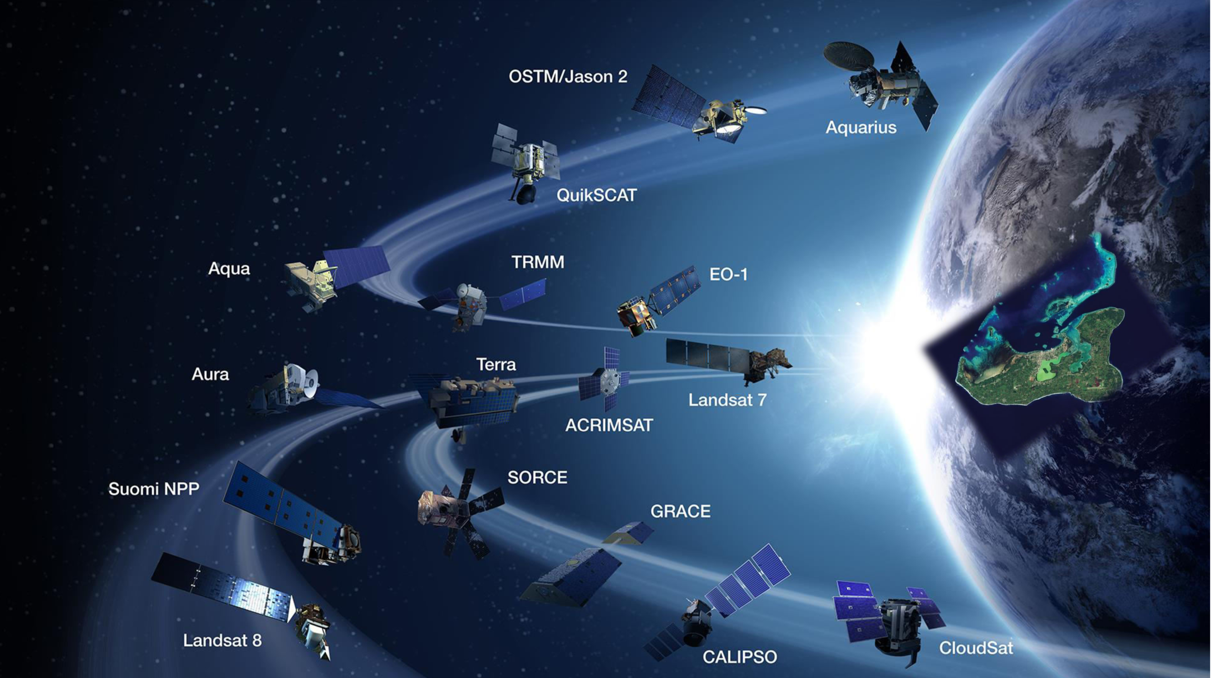
Photo Credit: NASA | Earth Science

Photo Credit: NASA | Earth Science

While Google Street View was launched in 2007 and has panoramic views of every continent, the Kingdom of Tonga will be the first in the world to participate in the Global Reach Initiative and Development (GRID) ‘whole of country’ programme. Moreover, with Tonga’s fast broadband capability and the fibre optic cable extensions to Vava’u and Ha’apai underway, Tonga is well positioned to become a 21st century powerhouse, who can utilise Street View to create a competitive advantage across multiple sectors.

Working in collaboration with Government Statistician Dr Viliami Fifita, the GRID Tonga Street View initiative was presented on World Statistics Day on 20th October with Prime Minister Hon. Samuela ‘Akilisi Pohiva, Minister of Finance and National Planning Dr Pohiva Tu’ionetoa, and Minister for Education and Training Hon. Penisimani Fifita in attendance.  Having used new technologies for the Tonga Census data collection, and being familiar with their effectiveness, Fifita said that the Global Reach Initiative “will be of great benefit to Tonga.”

The GRID Pacific Street View initiative contributes to great results for Tonga

  • Comprehensive maps and 3D street imagery accessible in Google Earth
  • Accurate GPS and GIS geospatial data (longitude & latitude)
  • Family and friends can connect virtually from anywhere in the world
  • Improved environmental and disaster planning and response
  • Increased capability with technology training and business development
  • Increased economic opportunities with global market reach
  • Authentic stories and local knowledge shared on global platforms

Google Street View Program Manager Mr Stafford Marquardt, who also presented on World Statistics Day in Tonga, is very excited about “working with GRID Tonga to help bring Street View to Tonga, and put it on the digital map.”

Although GRID Tonga will be focused on Street View in Tongatapu in December, Wolfgramm says that “in January and February our GRID Tonga team aims to travel to ‘Eua, Ha’apai, Vava’u, and ‘Ongo Niua to capture Street View data of the towns, villages, and sites on those beautiful islands. And we are grateful for the support of Tonga Post CEO Mr Siosifa Pomana and his team for providing experienced drivers who are familiar with all of the roads and villages of Tonga.”

With the GRID Tonga team heading to over 64 villages in Tongatapu over the next couple of weeks, this is a great time for Tonga to ‘look sharp’, prepare homesteads and villages, tidy up lawns, put up decorations, and put out signs. As GRID Tonga Manager and Creative Specialist Wikuki Kingi says, “Prepare your village to meet the world – share wonderful imagery of Tonga, and capture the imagination of millions of people everywhere.”

GRID Tonga Street View Data Acquisition Schedule-1.jpg

GRID Tonga scheduled to start in December

The GRID Street View Team is heading to your island, town, or village - starting in Tongatapu in December!

We aim to start out in Tongatapu on the 6th December, travelling across the whole island with our special Street View camera, covering Nuku'alofa and more than 70 villages over a period of several days. Weather permitting, we would love to take some 360 degree high resolutions photos of great sites including Ha'amonga, the Blow Holes, Ha'atafu, and some other sightseeing spots. Then in February and March we will head up to Ha'apai and Vava'u, and go over to 'Eua to capture data of the towns, villages, and sites on those beautiful islands. And we want to get our gear up to 'Ongo Niua for picking up Street View of the villages of Niuafo'ou and Niuatoputapu.

We will let everyone know when the GRID Google Street View Car will be heading your way - and we will keep you posted with the final schedule (weather permitting).

This will give you time to 'look sharp' - prepare your homestead, your village, tidy up your lawns, paint and put out your shop signs - yes, put your best foot forward and your friendliest smile on for the world!

And check out our Resources page for some cool posters - feel free to download them, share them, print them - have fun!

Looking forward to seeing you soon - Tania, Wikuki, Moka (GRID Pacific) and the Google Team :)

kingdom of tonga.png

Kingdom of Tonga - First in the World

The Kingdom of Tonga will be the first country in the world to participate in the Global Reach Initiative and Development (GRID) Pacific Programme.

The GRID Pacific Programme honours the vision and values of the people of Tonga, their cultural heritage and beliefs, and their passion and devotion for their wonderful kingdom.

The GRID Programme includes a number of interlinked phases including 1. Vision, Scope, Design; 2. Engage, Plan, Test; 3. Activate, Data Acquisition; 4. Data Processing, Review, Publishing, LiveLaunch; and 5. Ongoing Support, Training, Capability and Capacity Building.

Our GRID Programme Services* include: Whole of Country Mapping & Google Street View; 360 Degree Video; Unmanned Aerial Vehicle (UAV) / Drone Capture; Storytelling, Education, Tourism Apps; Augmented & Mixed Reality Apps; Virtual Reality Experiences; and much more...                 

The GRID Pacific Progamme links to Google System & Services including:

  • Google Earth - digital version of planet earth

  • Google Maps - web mapping service

  • Google Street View - 3D panoramic view

  • Google Voyager - showcase interactive tours

  • Google Search - most used web search engine

  • Google Chrome - freeware web browser

  • Gmail - free email service

  • Calendar - free calendar & events management

  • Translate - multilingual machine translation

  • YouTube – most used video-sharing website

*While some of these are offered free or at minimal cost, others have fees associated with them.


If you wish to find out more about our partnerships and participation in this Global Reach Initiative please contact GRID Executive Director Tania Wolfgramm on tania.wolfgramm@gmail.com